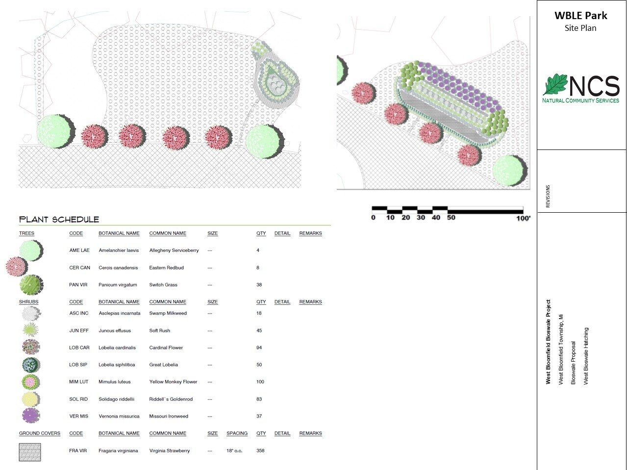
COVID-19 stranded & looking at your “greenup”, not knowing what to do? We CAN HELP, through remote-sensing and design software technologies! The pandemic stuff has made working a logistical nightmare in almost every vocation, ecological design included. .A variety of software programs have become embedded in nearly every step of the design process, from site inventory and analysis to final project deliverables and beyond. NCS can measure your site using GIS, analyze natural features inventory data, and producing drawings in CAD and image editing, rendering programs that help you see what your new place of plants and wildlife will look like. Software has evolved from tools to represent design to those actually affecting design ideas. It’s more than just software, as emerging technology such as drones, virtual reality (VR), LiDar, drive-by and oblique fixed-wing aerial vegetative interpretation, and 3-D rendering have enabled NCS designers to guide bioretention, stormwater, and native wildlife habitat planting designs remotely - we can. Whereas it was once adequate to master only a transit and sketch pad. We can GIS, Photoshop, and Sketchup grading and planting plans for colorful flood control and wildlife habitat today; and we’re giving you a unique spring-COVID-break 25% OFF discount on remote bioswale/rain garden design. Contact us today! john@naturalcommunityservices.com, or 248-672-7611